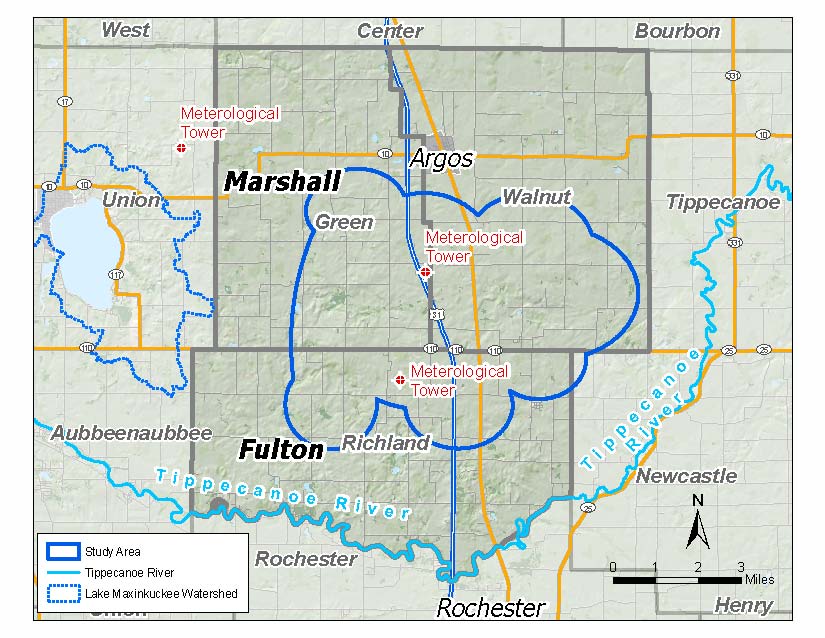
Above is the new map NextEra Energy has provided showing the area they are considering for their wind farm. This is the latest map provided to the Marshall County Economic Development Corporation (MCEDC). NextEra has moved the area they are considering further east than originally planned due to some of the concerns that have been expressed.
This map shows not only Lake Maxinkuckee, but a delineation of Lake Maxinkuckee’s watershed boundaries. As currently planned, there would be no towers within the watershed or within Union Township. I am pretty much putting this up here for informational purposes without much comment as it doesn’t really change my thoughts expressed here and here.
I had a brief conversation about this with the County Plan Director, Ralph Booker, today at the Broadband and Bagels event. He asked me if Culver was still planning to lynch him. It’s obvious that Culver as a community is straining some relationships with the County over this. I hope this doesn’t create a rift that makes future projects such as the recently completed Town/County outlet project impossible.